Esri to Donate Over $700,000 Worth of Software to Each Eligible Nation for Census Work
REDLANDS, Calif. — (BUSINESS WIRE) — April 18, 2018 — Esri, the global leader in spatial analytics, today announced the launch of the Esri Official Statistics Modernization Program, in which the company will donate perpetual use licenses for ArcGIS software to eligible official statistical agencies in Least Developed Countries (LDCs) and Small Island Developing States (SIDS). The program provides access to Esri ArcGIS Enterprise technology in support of the upcoming census counts that all countries will undertake during the Census, 2020 Round.
This press release features multimedia. View the full release here: https://www.businesswire.com/news/home/20180418005365/en/
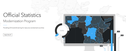
Esri announces the launch of the Esri Official Statistics Modernization Program, in which the company will donate perpetual use licenses for ArcGIS software to eligible official statistical agencies in Least Developed Countries (LDCs) and Small Island Developing States (SIDS). (Graphic: Business Wire)
The data collected as part of these census counts is crucial to nations for competing on the global stage. By using authoritative methods of collection and the cutting-edge mapping and analytics tools that Esri is donating, developing nations can gain an advantage in making data-driven policy decisions suited to a globalized economy.
The Esri Official Statistics Modernization Program provides access to the same software that hundreds of thousands of Esri customers—from public agencies to private enterprises—rely on every day to run their organizations. Esri will also provide guidance and best practices workflows at no cost so countries can implement their own systems to help with collecting data for their census.
"Population and housing censuses are big efforts for countries, especially those that may not have the resources readily available," said Linda Peters, Esri global business development manager. "These censuses are important, as the data collected is one of the primary sources of information needed for formulating, implementing, and monitoring policies aimed at inclusive socioeconomic development and sustainability."
Modernization efforts around census activities are helping countries leapfrog from paper-based workflows to digital and mobile ones. The United Nations (UN) expert group that specifically focuses on integrating statistical and geospatial information advised all countries to use a Global Statistical Geospatial Framework (GSGF) to aid in the modernization program. This framework requires nations using GIS technology like Esri's to ensure the implementation of up-to-date capabilities like data accessibility, ease of use of the technology, and the conversion of addresses into geographic coordinates on maps (geocoding).
The Esri Official Statistics Modernization Program was announced at the GIS for a Sustainable World conference in Geneva, Switzerland, co-organized by Esri and the UN. For more information on the program and nation eligibility, visit go.esri.com/officialstatisticsprogram.
About Esri
Esri, the global market leader in geographic information system (GIS) software, offers the most powerful mapping and spatial analytics technology available. Since 1969, Esri has helped customers unlock the full potential of data to improve operational and business results. Today, Esri software is deployed in more than 350,000 organizations including the world's largest cities, most national governments, 75 percent of Fortune 500 companies, and more than 7,000 colleges and universities. Esri engineers the most advanced solutions for digital transformation, the Internet of Things (IoT), and location analytics to inform the most authoritative maps in the world. Visit us at esri.com.
Copyright © 2018 Esri. All rights reserved. Esri, the Esri globe logo, The Science of Where, ArcGIS, esri.com, and @esri.com are trademarks, service marks, or registered marks of Esri in the United States, the European Community, or certain other jurisdictions. Other companies and products or services mentioned herein may be trademarks, service marks, or registered marks of their respective mark owners.
View source version on businesswire.com: https://www.businesswire.com/news/home/20180418005365/en/
Contact:
Esri
Karen Richardson
Public Relations
Mobile:
914-841-3180
Email:
Email Contact